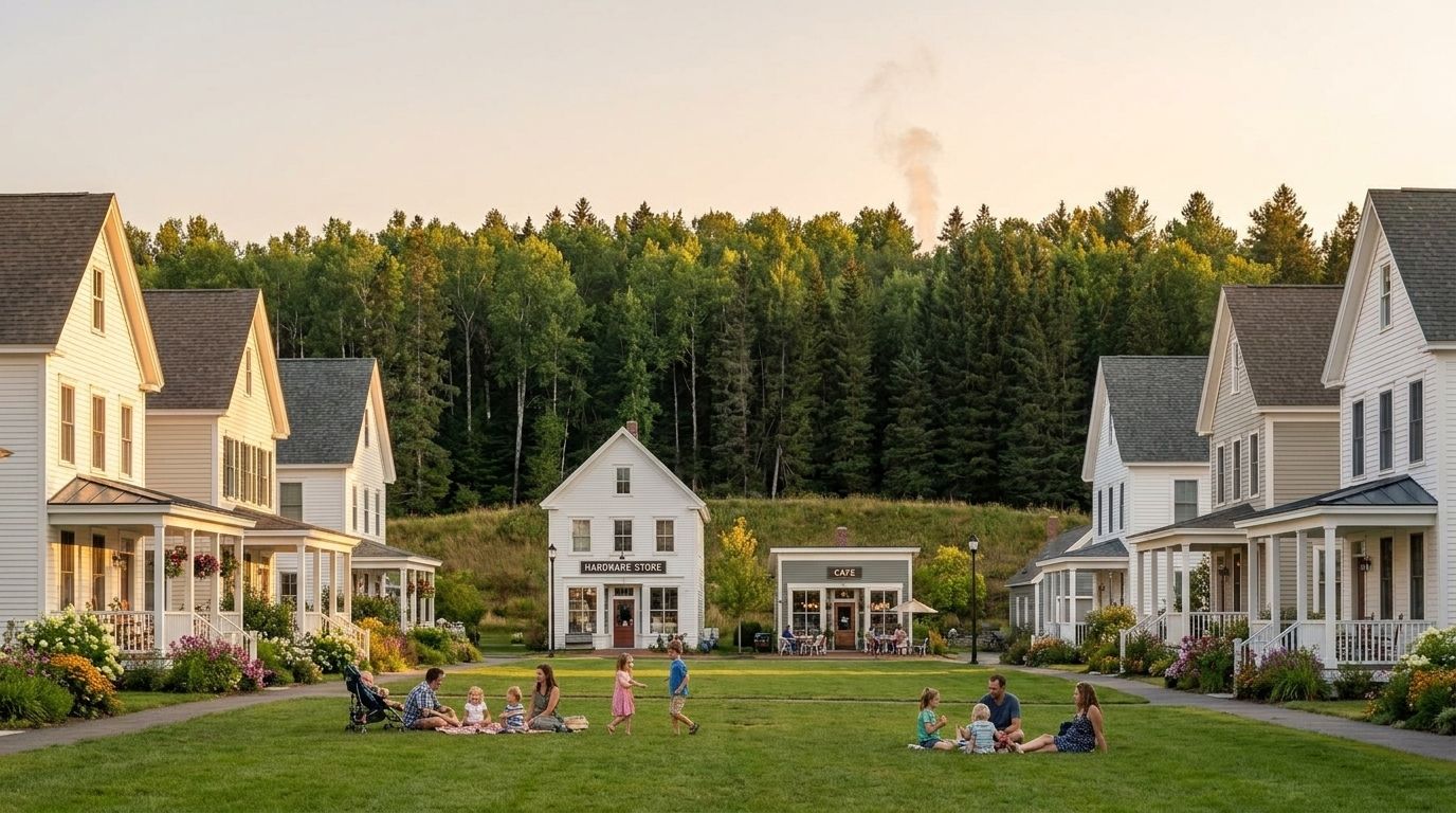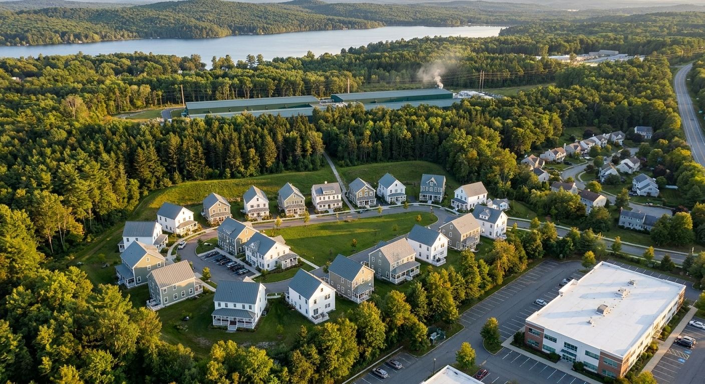
Concept aerial render of a small clapboard village in front of a tree band, with two low data halls along a utility corridor behind it and water beyond
Village Site Alpha · Central Maine · September 2026

Twenty megawatts and thirty homes, on two lots that already exist.

A village-scale first step studied lot by lot on a permitted business park in central Maine. Published in full, constraints included, and not by name: the owner and the town will hear from us before they read about themselves here. Conceptual image, Maine Vision 2040.
The Park

A permitted business park with the hard parts already done.

About 285 acres at an interstate interchange, owned by a regional development authority on behalf of two dozen towns and ten minutes from a service-center town. The subdivision is fully permitted by the state, the highway department and the Army Corps. Fiber and natural gas are on the lots. The covenants already list data centers as an approved use, alongside research, light manufacturing and healthcare. The host town's council has said publicly that it would rather recruit a data center than restrict one. Everything on this page comes from the park's public listing, its recorded subdivision plat, utility and elevation data, and local reporting.

148 acunsold, in eleven lots7 to 28 acres each, per the park's public listing
2 lotsstudied hereLot A, 20.8 acres, and Lot B, 28 acres with 14.1 held wild
1.8 mito a 115 kV substationBuilt about 2020 on a second transmission line into the area
Yesdata centers, by covenantHomes and shops are not, yet
The Concept

Campus on Lot A. Village on Lot B. Woods between and behind.

Lot A: two halls along the corridor

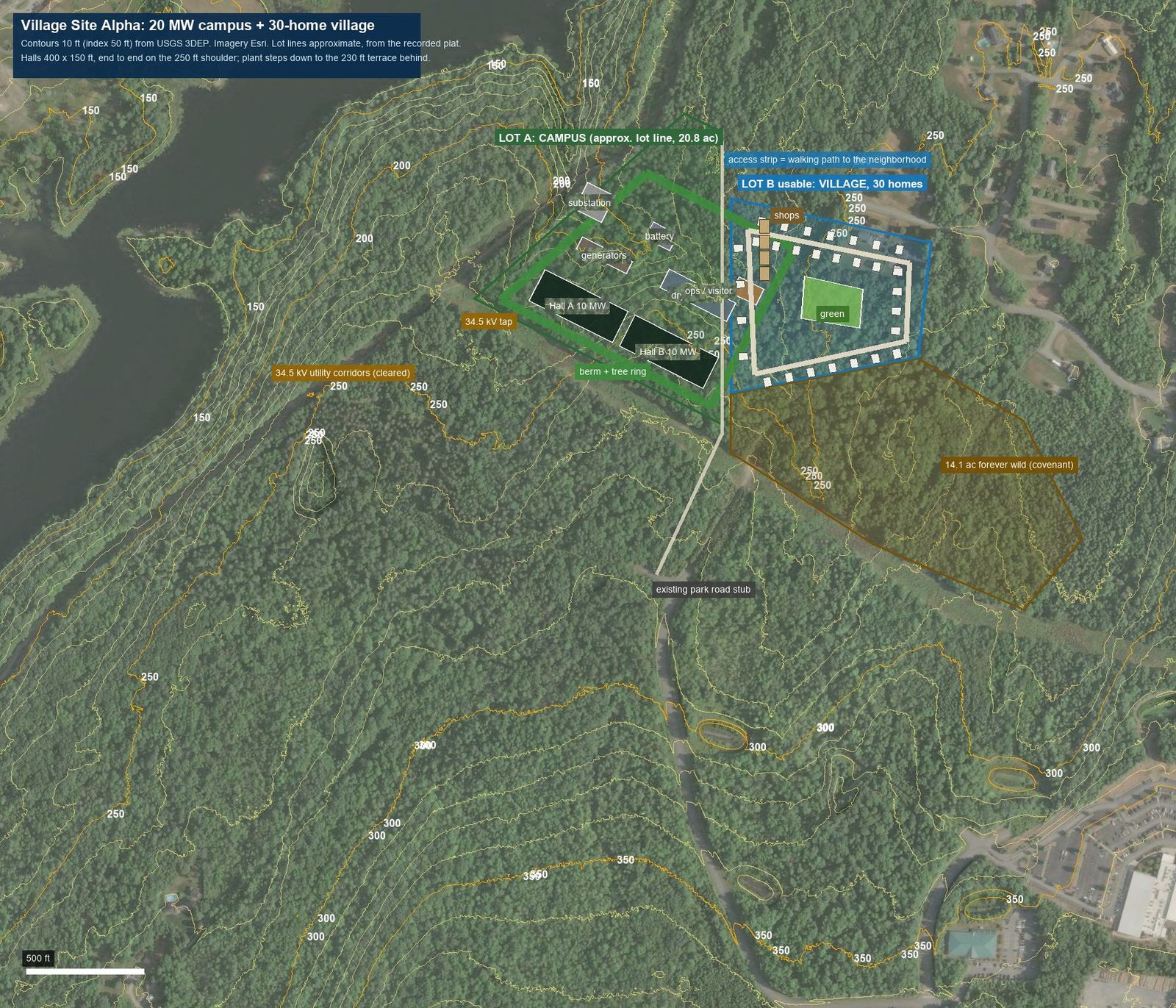
Lot A is a 20.8-acre wedge between two cleared utility corridors at the back of the park. Two 10 megawatt halls, 400 by 150 feet each, sit end to end along the corridor on the 250-foot shoulder. Cooling, generators, battery and the substation go on a lower terrace behind them. A berm and tree ring close the corridor and village sides. The service side faces the corridor, which is the only place the halls are meant to be seen from.

Lot B: thirty homes and a green

Lot B is 28 acres, but its southeasterly 14.1 acres are held in their natural state by the recorded plat, permanently, with a vernal pool inside. On the usable north part: a loop lane, about 30 homes in Maine clapboard, a green, and a few shops at the end of the lane. A 50-foot access strip between the lots becomes a walking path to the existing neighborhood on one side and the park road on the other. The wild 14 acres are the village's woods.

Footprint plan of two data halls on Lot A and a 30-home village on Lot B over satellite imagery with contours
Footprint plan over 10-foot contours from USGS elevation data. Lot lines are drawn from the recorded plat by eye and are approximate. Not an engineering drawing.
The Ground

The ridge does the hiding. The shoulder does the building.

Lot A is not flat. It runs about 260 feet along the corridor and falls roughly ten percent to the north, to a swale near a small pond at about 200 feet, then drops off its northwest corner toward the water at 150 feet. The buildable ground is the shoulder along the corridor, which is why the halls go end to end rather than side by side. The plant sits on the terrace behind, 20 to 40 feet lower, out of sight.

The park road and its office buildings sit at 290 to 360 feet. Both lots sit 50 to 100 feet below that. From anywhere in the park the halls are below the ridge. Lot B's usable ground is gentle, 234 to 256 feet, and drains toward the natural area it borders.

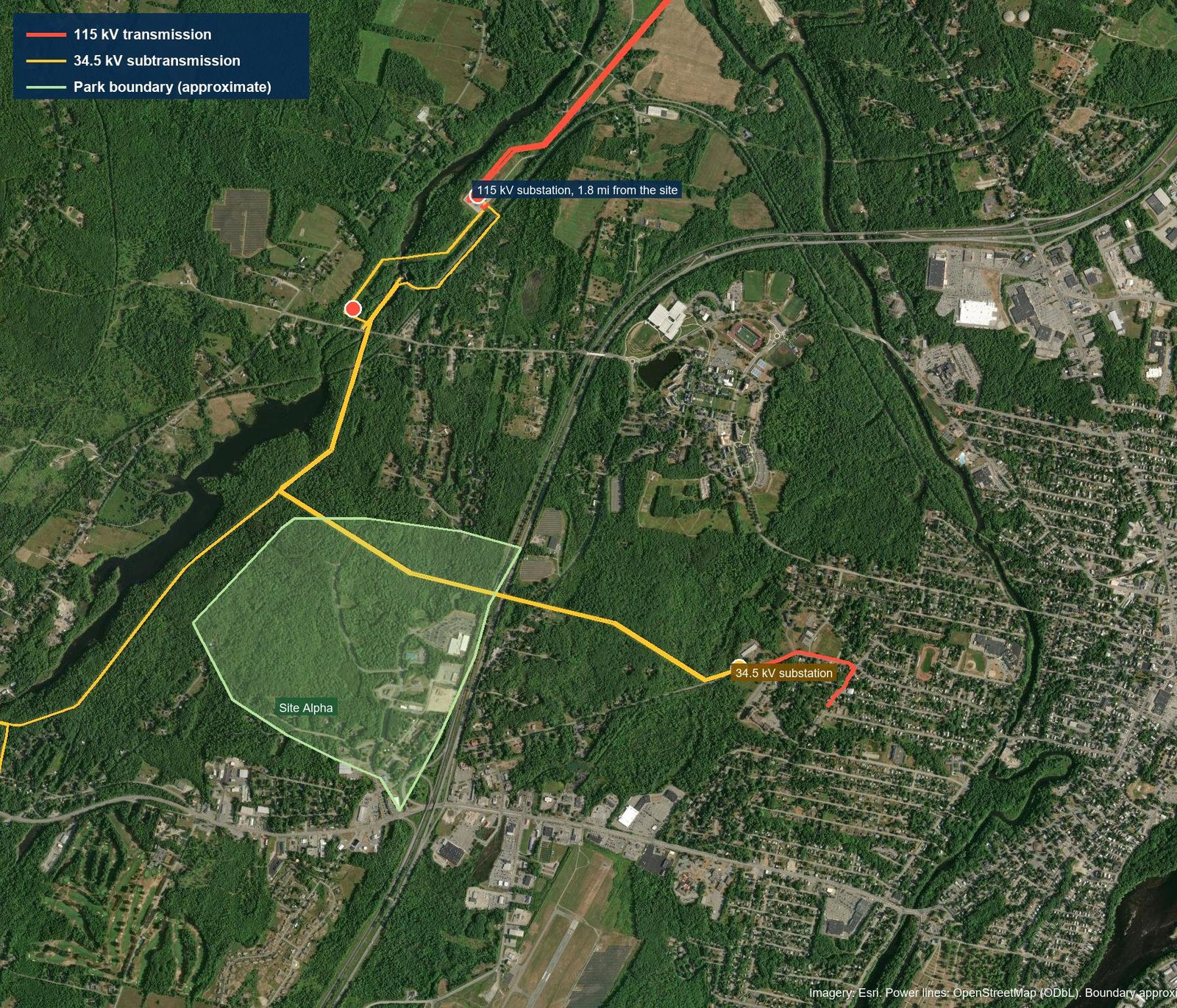
Satellite view showing a 115 kV substation north of the park and a 34.5 kV line running through it
The grid around the park: a 115 kV substation 1.8 miles away, a 34.5 kV line running through the park's northern lots toward the nearby town. The park's own service is an office-grade loop and cannot carry 20 megawatts. Power-line data from OpenStreetMap; park outline approximate.
The Vision

What it would look like, from the three places that matter.

Concept render of the village green with forest and a berm behind, no data hall visible
From the green. The design rule from the Village Test: nothing of the campus visible from any porch. Conceptual image.
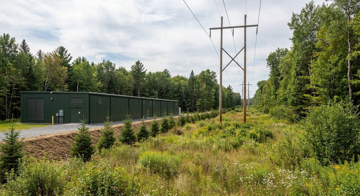
Concept render from inside the utility corridor showing the service side of a data hall behind a berm
From inside the corridor. The service side of a hall behind a berm and young spruce, nothing taller than the trees. Conceptual image.

The aerial at the top of the page is the third: the village in front, the tree band, the halls low along the corridor, the water beyond. All three are concept renders drawn from the plan above, not engineering.

What It Would Take

Four things have to be true before this is a site.

01

Power

A dedicated 34.5 kV feeder from the substation, or a 115 kV tap to a customer substation. Which one, at what cost and when, is a utility will-serve request that has not yet been made. It is the whole question.

02

Covenants and zoning

Homes and shops are not permitted uses in the park today. The village needs a covenant amendment from the authority and a zoning change from the town for one lot. The 14.1 natural acres cannot be changed by either.

03

Building rules

The park's size and parking guidelines were written for offices. A data hall needs variances on both, and the 30 percent footprint limit applies to halls, plant and yards together.

04

Gas and water

Pipeline gas serves the lots; capacity for honestly labeled bridge generation is unconfirmed. Town water and sewer capacity for a closed-loop liquid-cooled campus with a small summer trim is unconfirmed.

Constraints You Cannot See on the Map

The things a walk through the woods will not show you.

  • A vernal pool sits in the natural area. If it qualifies as significant under Maine's Natural Resources Protection Act, a 250-foot habitat buffer reaches into the buildable ground and could take a third of the village. Only a spring survey settles it.
  • Sound. Maine's Site Law limits night-time sound at homes to 45 decibels in rural settings. Cooling equipment and generator testing must be designed to meet that at the village and at the neighborhood next door, and the battery yard carries its own fire-code setbacks from homes.
  • Grid capacity. A 34.5 kV circuit carries a limited load and this one already serves customers in the nearby town; the substation's transformer capacity is the other half of the question.
  • Ledge. The park's soils are thin till over granite. Foundations, duct banks and the substation grounding grid mean blasting, next to homes and offices.
  • The corridor. Nothing can be built in the utility right of way, and every crossing and the tap itself need the utility's consent and engineering. The two cleared strips that make Lot A attractive also fence it.

And the permits that reopen

  • Stormwater and Site Law. The park's approved stormwater system was sized for office lots. A campus of this size reopens the Site Location of Development permit by amendment.
  • Wetlands. The natural area was set aside under the park's original Army Corps permit. Any new wetland impact, including the stream on Lot A's east side, is a new federal review.
  • Habitat and history. The stream and impoundment beside the park are mapped waterfowl and wading bird habitat, and their banks are sensitive for prehistoric sites; state wildlife and historic preservation review would apply.
  • Access. The strip between the lots is an emergency easement, not a road. Daily village traffic either comes through the park entrance or requires a new public connection the neighborhood would have to accept.
  • Bridge generation. Any on-site generation is a separately licensed air source with its own stack and sound, on Lot A, near the homes. It is not drawn on the plan yet.
What This Is

A desk study, published whole, and named later.

Back to the site screen See the village concept Talk with us